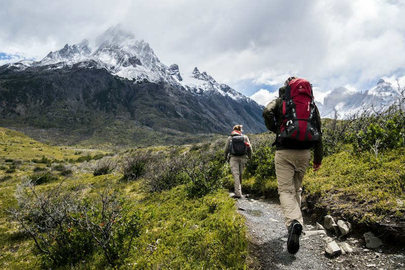
Hiking Trails Lehigh Valley: The Best Hikes for Every Kind of Walker
Quick Answer: The best hiking trails in the Lehigh Valley split cleanly by what you want from a walk. For a flat, shaded creekside loop, Lehigh Parkway in Allentown is the local default — 4.7 stars across 2,083 reviews in our directory data. For real climbing and valley views, the Wildlands Conservancy's South Mountain Preserve stacks nearly 12 miles of rocky woodland trail onto 440 acres of ridge. For the Valley's most ambitious day hike, the roughly nine-mile Border Trail at Trexler Nature Preserve circles open meadows where bison and elk still graze. And for flat-with-history, the Lehigh Canal towpath at Hugh Moore Park in Easton carries the D&L Trail past the National Canal Museum. Everything below is organized by hiker, not by alphabet.
Key Takeaways:
- Best flat walk: Lehigh Parkway — a crushed-stone loop of roughly six miles along the Little Lehigh Creek, past Bogert's Covered Bridge, with almost no elevation to speak of. 4.7 stars across 2,083 reviews in our directory data.
- Best serious hike inside the Valley: the Border Trail at Trexler Nature Preserve — about nine miles of steep, open, red-blazed loop around 1,108 acres, with bison and elk viewing built in.
- Best ridge-and-boulders terrain: South Mountain Preserve above Emmaus — 4.6 stars across 131 reviews in our directory data, with trails from a 0.2-mile ADA loop to genuinely difficult rocky climbs.
- Best hike with kids: Henry's Woods at Jacobsburg Environmental Education Center near Nazareth — a 1.9-mile easy loop under old hemlocks along the Bushkill Creek.
- Best long-distance option: the D&L Trail, a 165-mile canal-and-rail corridor that runs straight through Allentown, Bethlehem, and Easton — pick it up at Sand Island or Hugh Moore Park.
- Know before you go: Glen Onoko Falls remains closed to hikers, Blue Mountain trailhead lots fill early on nice weekends, and state game lands require fluorescent orange in late fall.
- Shortcut: Browse every green space we track — trailheads, ratings, and addresses — in our full Lehigh Valley parks directory.
What Counts as a Hiking Trail in the Lehigh Valley?
Hiking trails Lehigh Valley: A search that returns three very different kinds of walking — flat multi-use paths along the creeks and canals, wooded climbs on South Mountain and at Trexler, and the true ridge hikes up on Blue Mountain, where the Appalachian Trail runs the Valley's northern wall. Knowing which of the three you actually want is most of the work.
The geography does the sorting for you. The valley floor holds the easy stuff: creekside parkways in Allentown and Bethlehem, and the old Lehigh Canal towpath that the D&L Trail follows through all three cities. South Mountain rises just south of Allentown and Bethlehem with rocky, wooded trail networks you can reach in ten minutes. And Blue Mountain — the long ridge you see on the northern horizon — is where the best hikes in the Lehigh Valley get steep, stony, and genuinely rewarding, usually a 25 to 45 minute drive from the cities.
This guide covers all three tiers, plus what to bring, where parking actually fills up, and the two safety items — ticks and hunting seasons — that Pennsylvania hikers can't skip.
Where Are the Easiest Flat Walks?
If you want a walk, not a workout, the Valley's park systems are unusually generous.
Lehigh Parkway (Allentown)
Lehigh Parkway is the flagship — 4.7 stars across 2,083 reviews in our directory data, the most-reviewed trail destination we track. The main path is a wide crushed-stone loop of roughly six miles that follows the Little Lehigh Creek under mature shade trees, past stone WPA-era walls, Bogert's Covered Bridge, and a working trout hatchery. It's flat enough for strollers and joggers, soft enough to be easy on knees, and there are multiple lots (Park Drive off Lehigh Parkway North, Fish Hatchery Road, and near Bogert's Bridge) so you can shorten the loop however you like.
Monocacy Way (Bethlehem)
Bethlehem's answer runs along the Monocacy Creek between Sand Island and Monocacy Park (4.7 stars, 1,207 reviews in our directory data). The full route is a bit over four miles with barely 100 feet of elevation change, on a mix of gravel, natural surface, and newer paved sections. It passes the Colonial Industrial Quarter and Burnside Plantation on its way north to Illick's Mill — more on the history angle below. One honest caution: the crossing at Schoenersville Road is unmarked, so mind the traffic there.
The everyday loops
For shorter strolls, Allentown's Trexler Memorial Park (4.8 stars, 1,443 reviews in our directory data) and the adjoining Cedar Creek Park and Cedar Beach Park corridor form a connected, mostly flat green ribbon along Cedar Creek. Out in Northampton County, Louise W. Moore Park near Easton has a 1.1-mile paved inner loop plus more than three miles of trail across 120 acres — one of the best ADA-friendly options in the region. None of these are hikes in the boots-required sense; all of them are exactly what a Tuesday evening calls for.
Which Trails Work Best for Families With Kids?
Three picks, in ascending order of adventure.
First, Henry's Woods at Jacobsburg Environmental Education Center, just north of Nazareth. The 1.9-mile loop is the park's signature: an easy, shaded circuit where the Bushkill Creek slides past slate outcroppings and old stands of hemlock and white oak. It feels like a much wilder place than the mileage suggests, which is precisely what you want with a seven-year-old.
Second, Lock Ridge Park in Alburtis (4.6 stars, 361 reviews in our directory data). The walking loop here is short — well under a mile — but it circles the stone ruins of an 1868 iron furnace that looks, to a kid, exactly like a ruined castle. The furnace museum opens on summer weekend afternoons, and the surrounding woods and creek make an easy hour.
Third, the elk and bison at Trexler Nature Preserve. You don't need to hike the full Border Trail to see the animals — shorter walks from the preserve's parking areas off Game Preserve Road get you to viewing points over the ranges where the herds graze. General Harry Trexler started the bison herd here more than a century ago, and it's still the only hike in the region where the wildlife checklist includes something that weighs a ton. If the kids want a different kind of climbing afterward, Hangdog Outdoor Adventure in Easton (4.8 stars, 116 reviews in our directory data) runs an aerial ropes course through the trees.
Where Are the Best Views and Ridge Hikes?
This is what most people mean when they search for the best hikes in the Lehigh Valley — somewhere the ground goes up and the view pays it back.
South Mountain Preserve (Emmaus)
The Wildlands Conservancy's South Mountain Preserve — 4.6 stars, 131 reviews in our directory data — is the closest real hiking to Allentown, 440 acres of heavily forested ridge with nearly 12 miles of trail. The main entrance is on Alpine Street in Emmaus. The Alpine St Trail (1.7 miles, rated difficult by the Conservancy) is the rocky climb that unlocks the upper trail network, threading boulder formations and reclaimed quarry sites. The payoff is the Trout Run Trail, a 1.2-mile moderate stretch with a genuine overlook of Emmaus and Allentown through a utility cut, plus small streams and big glacial boulders. There's also a 0.2-mile ADA loop and the accessible Kline's Lane Trail at the bottom, so the preserve scales from wheelchair-friendly to legitimately hard. Open dawn to dusk, no fires, no camping, stay on the trails.
Trexler's Border Trail (Schnecksville)
The red-blazed Border Trail at Trexler Nature Preserve is the Valley's best single-day challenge: about nine miles around the perimeter of the 1,108-acre preserve, with several genuinely steep pitches, long switchbacks, a stream crossing, and — unusually for Pennsylvania hiking — big open meadows with long sightlines toward Blue Mountain. Most hikers treat it as a half-day. The Environmental Center in the Central Range makes a good midpoint, and shorter loops in each range let you sample the terrain without committing to the full circle.
Bake Oven Knob (Germansville)
For maximum view per step, drive 30 minutes northwest of Allentown to Bake Oven Knob on the Appalachian Trail. From the gravel lots on Bake Oven Road, the white-blazed AT reaches the rocky summit outcrop in well under a mile — a short, stony scramble to a sweeping look over the farmland quilt of Lehigh and Carbon counties. In fall, it's one of the East's classic hawk-watching perches. Two things to know: the footing on top is jumbled rock, not a paved platform, and the lots sit on State Game Lands 217, which matters during hunting season (see the safety section below).
Which Hikes Are the Longest?
The Valley's long-distance backbone is the D&L Trail — the Delaware & Lehigh National Heritage Corridor's 165-mile route from the Wilkes-Barre area down to Bristol, following the old Lehigh Valley Railroad and the Lehigh and Delaware canals. Roughly 48 of those miles pass through the Lehigh Valley region, connecting Allentown, Bethlehem, and Easton on a mostly flat crushed-stone and towpath surface. You can walk out of Sand Island Park in Bethlehem (4.4 stars, 1,015 reviews in our directory data) and keep going toward Easton for as many miles as your legs want, with the Lehigh River for company the whole way.
One planning note: the D&L is a work in progress, and a gap in the Allentown area has been under construction with completion targeted around 2027 — check the trail's current maps before planning a long point-to-point through that stretch.
Off the towpath, the two longest true hikes are Trexler's roughly nine-mile Border Trail and a full tour of South Mountain Preserve's upper network, where stringing together the Alpine, Trout Run, Bug, Uplands, and Log trails yields a rugged day that feels far bigger than its acreage. And the Appalachian Trail itself runs the entire northern rim of the Valley — section hikers use Bake Oven Road, Lehigh Gap, and Route 309 as trailheads and walk ridge line all day.
Which Trails Are Dog-Friendly?
Almost all of them, with one consistent condition: leashes. Wildlands Conservancy requires pets leashed and cleaned-up-after at South Mountain Preserve; leashed dogs are welcome at Trexler Nature Preserve, on the Lehigh Parkway loop, along the D&L towpath, and at Jacobsburg, which follows standard Pennsylvania state park pet rules.
Practical dog notes from people who actually walk them here: the Parkway and the towpath are the easy wins — flat, shaded, with creek access for hot days. Trexler's open meadows are gorgeous but nearly shadeless in summer, so carry water for the dog, and keep leashes genuinely on around the elk and bison enclosures. On the AT's rocky sections, Pennsylvania's famous stones are hard on paws; work up to Bake Oven Knob rather than starting there. And during late-fall hunting seasons on game lands, your dog needs blaze orange too — a collar, bandana, or vest.
Are There Waterfall Hikes Near the Lehigh Valley?
Here's the plain answer, because it's a safety issue: Glen Onoko Falls, the famous waterfall climb at Jim Thorpe, is closed to hikers and has been since 2019. The steep falls trail was shut down over serious safety concerns after years of injuries and rescues, and it remains closed while a multi-year rehabilitation rebuilds it with stone steps and retaining walls — work that continues through 2026. Don't hike it, don't follow social media posts around the barriers, and don't plan a trip assuming it's open. When the state announces a reopening, it will be well publicized.
The legal alternative in the same landscape is Lehigh Gorge State Park, where the D&L Trail runs the gorge floor past cliffs, rapids, and seasonal cascades that spill down the gorge walls — flat walking, big scenery, about 45 minutes north of Allentown. Closer to home, moving water is the Valley's consolation prize: the Bushkill Creek at Jacobsburg, the dam and falls at Monocacy Park, and Wehr's Dam beside the covered bridge at Covered Bridge Park (4.8 stars, 1,249 reviews in our directory data) all deliver the sound of water without the closed-trail risk.
Which Trails Come With the Best History?
The Lehigh Valley's trails are mostly repurposed industry, and the best of them wear it openly.
The Lehigh Canal towpath at Hugh Moore Park
Hugh Moore Park in Easton — 4.7 stars, 1,299 reviews in our directory data — is the standout. A 2.5-mile section of the D&L Trail runs through the park on the actual Lehigh Canal towpath, which opened to mule traffic in 1829. You walk between the river and the watered canal, past the National Canal Museum, a locktender's house, and, in season, a mule-drawn canal boat. It is flat, stroller-friendly, and the single best walk in the region for understanding why any of these towns exist.
Iron, mills, and Moravians
Lock Ridge Park's loop circles a furnace that made iron from 1868 to 1921. Monocacy Way passes Bethlehem's 18th-century Colonial Industrial Quarter and the Burnside Plantation farmstead. Even South Mountain hides its past: the Wilderness Trail on the preserve's lower slopes passes old mining pits from the ridge's iron-ore days, now reclaimed as amphibian pools. Jacobsburg, for its part, surrounds the historic Boulton site, where the Henry family's gun works operated for generations. If industrial-era walking is your thing, our Easton parks guide and Bethlehem parks guide go deeper.
Which Trail Matches Your Kind of Hiker?
- The stroller-pusher: Lehigh Parkway — flat crushed stone, shade, a covered bridge for the photo.
- The after-work decompressor: Monocacy Way from Monocacy Park, or the Trexler Memorial–Cedar Creek corridor.
- The trail runner: South Mountain Preserve's upper loops — rocky, switchbacked, empty on weekday mornings.
- The half-day challenger: Trexler's Border Trail, about nine miles with real climbing.
- The view collector: Bake Oven Knob for the short scramble; the Pinnacle (below) for the full pilgrimage.
- The history walker: The towpath at Hugh Moore Park, then Lock Ridge Park's furnace ruins.
- The family with young kids: Henry's Woods at Jacobsburg, with ice cream after — our Lehigh Valley ice cream guide has the nearest scoop.
Can You Hike These Trails in Winter?
Yes — winter is arguably the Valley's underrated season. The flat corridors (Lehigh Parkway, Monocacy Way, the D&L towpath) are plowed-adjacent and walkable in ordinary boots most of the season, and bare trees open up river views the summer canopy hides. Trexler is a designated cross-country skiing and snowshoeing destination when snow actually sticks, and its open ranges are spectacular under snow — though fully exposed to wind, so dress for it.
The ridge is a different calculation. Pennsylvania's rocky AT sections ice over and stay iced in shaded stretches; microspikes turn Bake Oven Knob from sketchy to pleasant. Days are short — most preserves, including South Mountain, close at dusk — so start by early afternoon. And know that late November through mid-December is rifle deer season, which changes what you wear on game lands (see below).
When Is the Best Season for Hiking Here?
Every season works; they just reward different trails. Spring is for water and wildflowers — Jacobsburg's creek runs full, and South Mountain's skunk cabbage and spring ephemerals arrive absurdly early. Summer pushes you to shade: the Parkway, Henry's Woods, and the towpath stay comfortable when Trexler's open meadows bake. Fall is the headline act — foliage on the Border Trail's long views, and the annual hawk migration streaming past Bake Oven Knob. Winter belongs to the flat corridors and the snowshoe days at Trexler.
The crowd calendar matters as much as the weather one: the first warm Saturdays of spring and every peak-foliage October weekend are when the popular lots overflow. Go early, go weekday, or go to the second-choice trailhead.
Local rule of thumb: If it rained hard yesterday, hike up, not along. The creekside paths — the Parkway, Monocacy Way, stretches of towpath — flood and hold mud for days, while South Mountain's rocky slopes and Trexler's high meadows drain almost immediately. The ridge is for wet weeks; the creeks are for dry ones.
What Should You Bring on a Lehigh Valley Hike?
For the flat corridors, nothing exotic: water, sunscreen on the open stretches, and a phone. The real packing list starts when you leave the valley floor.
For South Mountain, Trexler, and anything on Blue Mountain: sturdy shoes with real soles (Pennsylvania's trail rock is pointy and famously unkind), more water than feels necessary — there is no potable water on the ridge, and don't drink from streams untreated — bug spray, a paper or downloaded map since ridge cell coverage is patchy, and a headlamp any time you start after noon in the shorter months. In tick season, which here means roughly April through November, add permethrin-treated clothing. In hunting season, add blaze orange. A small first-aid kit earns its weight the first time someone rolls an ankle on AT rocks.
What About Ticks, Hunting Seasons, and Other Safety Issues?
Two Pennsylvania-specific items deserve their own section, because out-of-state transplants are routinely surprised by both.
Ticks and Lyme disease
Pennsylvania consistently reports among the most Lyme disease cases in the country, and blacklegged ticks have been found in all 67 counties. The Valley's meadow-edge and brushy trails — exactly the terrain at Trexler and on game lands — are prime habitat. The standard defense stack works: permethrin sprayed on shoes and clothing (not skin), DEET or picaridin on skin, long pants tucked into socks in high grass, walking the center of the path, and a full-body tick check the same evening — plus a careful hand-over of any dog before it gets on the couch. Found ticks come off with fine tweezers, straight out; a bullseye rash or fever in the following weeks means a doctor visit, promptly.
Hunting seasons and blaze orange
Bake Oven Knob and much of the Blue Mountain ridge sit on state game lands, where hunting is the primary use. Pennsylvania law requires everyone on state game lands — hikers included — to wear at least 250 square inches of fluorescent orange on head, chest, and back from November 15 through December 15, and orange is smart practice through all of fall on any land where hunting is allowed. Note that Trexler Nature Preserve's North Range hosts archery deer hunting in season, so check the county's notices and stay on marked trails there in autumn. Sundays have historically been the quieter day for hunting, but limited Sunday hunting now exists in Pennsylvania — wear the orange regardless.
Everything else
The remaining hazards are ordinary but real: no water sources on the ridge, loose rock at every overlook (Bake Oven Knob's summit rocks demand attention with kids), copperheads and timber rattlesnakes sunning on warm ledges in summer (give them room; they want nothing to do with you), and dusk closures at most preserves. None of it should stop you; all of it should be in your head before you leave the car.
Where Do You Park, and Do the Lots Fill Up?
Valley-floor parks are easy: Lehigh Parkway, Monocacy Park, Hugh Moore Park, and Sand Island all have multiple real lots, and only summer festival days strain them. The friction is at the trailheads everyone drives to.
Bake Oven Knob's gravel lots on Bake Oven Road are the most notorious — modest in size, at the end of a rough gravel road, and reliably full by mid-morning on any nice weekend, with overflow parking along the road adding scratches to fenders every October. South Mountain Preserve's Alpine Street entrance is a small neighborhood trailhead: arrive early, park considerately, and don't block Emmaus residents' driveways — the Conservancy's good standing with its neighbors is part of why the preserve exists. Trexler has several lots across its ranges off Game Preserve Road, which spreads the load; the lot nearest the Environmental Center is the busiest. Jacobsburg's main Belfast Road lot fills on peak fall weekends, but the Boulton lot on Henry Road usually has room. The universal fix is boring and effective: be there before 9 a.m., or come on a weekday and have the ridge nearly to yourself.
What's Worth the Drive Beyond the Valley?
Two trips justify the gas money. The first is the Pinnacle–Pulpit Rock loop near Hamburg, about 40 minutes west of Allentown: a roughly nine-mile circuit from the Hamburg Reservoir lot with around 1,200 feet of climbing, hitting two rock outcrops on the Appalachian Trail. The Pinnacle's view over the Kutztown-area farmland is widely called the best on Pennsylvania's entire AT stretch, and on fall weekends the reservoir lot fills accordingly — early arrival is not optional. The footing is classic PA rock; wear boots, not sneakers.
The second is Lehigh Gorge State Park at Jim Thorpe, about 45 minutes north, where the D&L Trail runs flat through a genuinely dramatic river gorge — the easy-walking counterpart to the closed Glen Onoko falls trail next door. Add a walk around Jim Thorpe's Victorian downtown and it's a full day. For everything closer to home — playgrounds, pavilions, swimming, disc golf — our Allentown parks guide and the broader things to do in the Lehigh Valley roundup cover the rest of the map.
Bottom Line: Match the Trail to the Day
The hiking trails in the Lehigh Valley aren't one list — they're a ladder. The bottom rungs are world-class easy walking: Lehigh Parkway, Monocacy Way, and the canal towpath at Hugh Moore Park, all backed by some of the highest ratings in our parks directory. The middle rungs — South Mountain Preserve and Trexler's Border Trail — deliver real climbing and real views inside a 20-minute drive, which is genuine hiking near Allentown by any standard. And the top rungs are the Blue Mountain classics, Bake Oven Knob and the Pinnacle, where the Appalachian Trail earns its reputation one pointy rock at a time. Check the closures, pack the orange in November, beat the lot, and the Valley will hand you a different great hike every weekend of the year.
Find the best local businesses in Lehigh Valley. Browse our full parks directory for every trailhead and green space, refuel afterward with our coffee shops directory, or earn a post-hike pint with our Lehigh Valley breweries guide — real places vetted by locals.