Appalachian Trail Gear List: Day Hikes from the Lehigh Valley
As an Amazon Associate we earn from qualifying purchases.
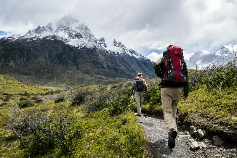
Quick answer: For a day hike on the Appalachian Trail near the Lehigh Valley, carry the National Park Service Ten Essentials, shoes that can handle boulders, at least 2 liters of water, a warm layer and a rain shell, and fluorescent orange on State Game Lands during the dates in the Pennsylvania Game Commission's 2026–27 digest.
Which trail to pick is a different page: our hiking trails in the Lehigh Valley guide. This page is what to carry once you have picked. Facts below were checked October 23, 2026.
The AT near the Lehigh Valley
The Conservancy's Pennsylvania page calls the rocks "Rocksylvania" and prints 230.0 miles, 26 shelters, and an elevation range of 380 to 2,080 feet. The Allentown Hiking Club maintains 10.3 miles, including the Allentown Shelter north of New Tripoli. The municipal guide describes the white blaze as a 2-by-6-inch vertical rectangle. Drives below start at Allentown City Hall, 435 Hamilton Street. Each figure is a free-flow OpenStreetMap time measured October 23, 2026, not live traffic.
Lehigh Gap. Lehigh Gap Nature Center, 8844 Paint Mill Road, Slatington, PA 18080, is open sunrise to sunset. It has more than 13 miles of trail on 756 acres, the only D&L–AT connection there. The AT piece is 1.5 miles, challenging, 30 minutes to an hour, moderate to steep, white blazes to Route 873. Follow the blazes. A reroute is still underway. Footing runs from packed dirt and stone to large boulders and roots, and it is slippery after rain, snow, ice, or leaves. Osprey House (40.7841565, -75.6090353) was 17.9 miles and 29.2 minutes. The Superintendent's Compendium says the separate PA-248 railroad-bed lot is daylight-only and still allows overnight parking by backpackers. The Palmerton reroute reports a 3.25-mile relocation east of the river, about 0.2 miles longer. Stay off the closed 2008–2022 route. It crosses private land.
Bake Oven Knob. The hike page lists an easy 0.8-mile walk: north to the summit, printed elevation 1,560, at mile 0.4, a north view then a south view, then turn around. From Germans Road in Andreas, follow Bake Oven Road south 1.7 miles. The trail crossing (40.7444026, -75.7382947), not the summit, was 21.2 miles and 44.7 minutes.
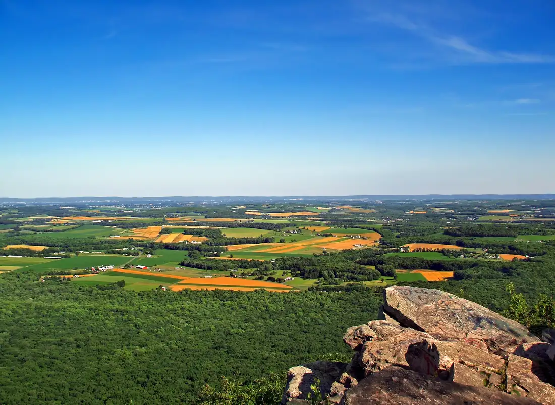
The Pinnacle. The municipal guide calls the view one of the most popular Appalachian Trail vistas in Pennsylvania, in Berks County, and prints no mileage or address. Hamburg Borough says Hamburg Reservoir, Reservoir Road, Hamburg, PA 19526, starts the Appalachian Trail, Pulpit Rock, and the Pinnacle, from half an hour before dawn until half an hour after dusk. The borough owns the land and bans overnight parking, camping, fires, littering, swimming, fishing, alcohol, tree stands, vehicles, and cutting vegetation. Phone 610-562-7821. The parking pin (40.5830295, -75.9421457) was 28.0 miles and 43.5 minutes. No trail length is printed here, because neither source gave one.
Day-hike gear checklist
The Ten Essentials, updated May 28, 2026, sorts gear into ten systems and credits The Mountaineers. Tell someone your plan. "See options on Amazon" is a category search, with no price and no rating on this page.
| Item | Why on this section | Buy or borrow |
|---|---|---|
| Navigation | Map and compass. The Gap reroute makes an old track wrong. | See options on Amazon |
| Sun protection | Open ridge: sunglasses, sunscreen, a hat. | Borrow a hat |
| Extra clothing | Rain shell and a warm midlayer. | See options on Amazon |
| Headlamp | Hands-free light. December sunset is before 5 p.m. | See options on Amazon |
| First aid | Small kit, dates checked, plus your medicine. | See options on Amazon |
| Fire starter | Matches or a lighter, only where fires are allowed. | Borrow a lighter |
| Repair kit | Knife or multi-tool, and tape. | Borrow |
| Food | More than the walk should take. | Grocery store |
| Water | At least 2 liters, plus a way to treat more. | See options on Amazon |
| Emergency shelter | Space blanket or light tarp past dusk. | Borrow |
| Day pack, about 20–30 L | Water, a layer, and the kit. | See options on Amazon |
| Gaiters | Keeps Gap gravel out of the shoe. | See options on Amazon |
| Trekking poles | The Gap descent is rocky and steep. | See options on Amazon |
| Blaze-orange hat | Non-hunter rule on State Game Lands. | See options on Amazon |
Footwear for Pennsylvania rocks
No page requires a boot. A waterproof boot has a higher ankle and a lug sole. See options on Amazon and See options on Amazon. A trail runner is lower at the ankle, with sticky rubber and a rock plate under the forefoot. Gaiters close the cuff. Merino socks stay warmer than wet cotton. See options on Amazon. Poles ease the descent and are not required. Borrow a pair once. See options on Amazon.
Water and food
Carry at least 2 liters. That minimum is this page's, not the Conservancy's. The Bake Oven Knob page lists no faucet and no spring. Treat water you collect. The nature center's loop guide says one signed refuge loop passes a shelter and a spring, that hikers may use the spring if they filter or treat it, and that the shelter is for thru-hikers only. That spring is not at the knob or the Pinnacle. See options on Amazon. Carry it in a bladder of about 2 liters, or in bottles that add up.
Pack more food than the walk should take. The Ten Essentials page names trail mix, nuts, and granola bars. Skip the stove. The refuge prohibits open fires. On State Game Lands a small cooking or warming fire is allowed only if contained and tended, and not when the Department of Conservation and Natural Resources fire index is high, very high, or extreme.
Winter on the ridge
November through March is the layer season. Figures are 1991–2020 normals for Allentown International Airport, station USW00014737, 390 feet, from NOAA's U.S. Climate Normals, checked October 23, 2026. High / low / snowfall: November 53.8°F / 34.1°F / 0.9 in; December 43.1 / 26.8 / 4.6; January 38.4 / 21.8 / 9.8; February 41.6 / 23.2 / 10.8; March 50.8 / 30.5 / 6.3. Days at or below 32°F: November 14.9, December 23.8, January 26.7, February 23.8, March 19.3. Station history is the KABE climate archive. Read the NWS Philadelphia / Mount Holly forecast the morning you go. Bake Oven Knob is printed at 1,560, more than a thousand feet above the airport.
The U.S. Naval Observatory for 40.604, -75.467, Eastern Standard Time, checked October 23, 2026: November 15, 2026, sunrise 6:49 a.m., sunset 4:44 p.m.; December 21, 2026, 7:22 a.m. and 4:38 p.m.; March 1, 2027, 6:36 a.m. and 5:53 p.m. Carry a headlamp. See options on Amazon are for ice, not a reason to stay on glaze you do not trust. Wear a fleece midlayer under a waterproof breathable shell, plus a hat and gloves.
Fluorescent orange
The 2026–27 Hunting & Trapping Digest makes it unlawful to be on State Game Lands from October 1 through January 31 and from April 20 through May 31, including Sundays, without at least 250 square inches of fluorescent orange on the head, chest, and back combined, or a fluorescent orange hat visible 360 degrees, unless you are lawfully hunting, trapping, or fishing in a season that does not require orange. Shooting-range users are exempt. Statewide regular firearms deer season is November 28 through December 13. Statewide archery is October 3 through November 20 and December 26 through January 24, 2027. Wear orange for the longer game-lands window, not only those two rifle weeks.
Hunting and discharging firearms are prohibited on National Park Service land acquired for the trail, not on State Game Lands sections. The refuge prohibits hunting and firearms. The Woodpecker Trail, a nature-center connector, is inside State Game Lands 217, where hunting is allowed in season. The Conservancy's Pennsylvania page still prints November 15 to December 15. Both were checked October 23, 2026. Follow the digest. Groups of 10 or more on game lands, trails included, need a Special Use Permit.
Leave No Trace and trail rules
Leave No Trace names seven principles: plan ahead and prepare, travel and camp on durable surfaces, dispose of waste properly, leave what you find, minimize campfire impacts, respect wildlife, and be considerate of others. Stay on the blazes and pack out wrappers. The refuge requires leashed dogs. Hamburg bans overnight parking. Obey a sign at the lot if it disagrees with this page.
Going further
A longer trip needs a larger pack and a legal place to sleep. This page does not pack it. The Conservancy's Pennsylvania page lists 26 shelters and the clubs. Refuge camping, and the loop-guide shelter, are for thru-hikers only. Bear canisters are not required in Pennsylvania. The Conservancy still recommends them for campers and says the Blue Mountain Eagle Climbing Club and Berks County Parks lend them free at the Berks Leisure Area in Wyomissing.
After the hike
Eat back in the Valley: things to do in the Lehigh Valley and the Allentown restaurant directory. The Water Gap, a different drive, is in day trips from the Lehigh Valley. Closer walks that are not this trail: Lehigh Parkway and South Mountain Preserve. The hiking guide sorts them.
Frequently Asked Questions
What gear do you need to hike the Appalachian Trail?
For a day hike, use the National Park Service Ten Essentials: navigation, sun protection, extra clothing, a headlamp, first aid, a fire starter, a repair kit, extra food, water plus a way to treat it, and an emergency shelter. Add shoes for boulders and fluorescent orange on State Game Lands in the 2026–27 digest windows.
Where can you hike the AT near Allentown?
Measured October 23, 2026 from Allentown City Hall on OpenStreetMap, free-flow, not live traffic. Lehigh Gap Nature Center, 8844 Paint Mill Road, Slatington: 17.9 miles and 29.2 minutes. The trail crossing of Bake Oven Road: 21.2 miles and 44.7 minutes. Hamburg Reservoir on Reservoir Road, the borough start for the Pinnacle: 28.0 miles and 43.5 minutes.
Do I need hiking boots for the AT in Pennsylvania?
No rule requires boots. The Conservancy calls Pennsylvania "Rocksylvania." Lehigh Gap footing runs from packed dirt and stone to large boulders and roots, and it is slippery after rain, snow, ice, or leaves. Waterproof boots with a lug sole are one answer. Trail runners with a rock plate are the other.
Do I need to wear orange on the AT in hunting season?
On State Game Lands, yes. From October 1 through January 31 and April 20 through May 31, Sundays included, the 2026–27 digest requires 250 square inches of fluorescent orange on the head, chest, and back combined, or a hat visible 360 degrees, unless you are lawfully hunting, trapping, or fishing in a season that does not require it. Shooting ranges are exempt. National Park Service land bought for the trail prohibits hunting and firearms. The Conservancy still prints November 15 to December 15. Follow the digest.
What to bring on a winter day hike?
Bring a midlayer, a rain shell, a hat, gloves, and traction. Allentown airport normals for 1991–2020 put January at 38.4°F and 21.8°F, with 9.8 inches of snow, at 390 feet. Bake Oven Knob is printed at 1,560. On December 21, 2026, sunrise is 7:22 a.m. and sunset is 4:38 p.m. Eastern Standard Time. Carry a headlamp and check the National Weather Service that morning.
Are trekking poles worth it?
Borrow a pair for the Lehigh Gap descent before you buy. That section is challenging, moderate to steep, with boulders and roots. Poles spare the knees on the way down. No rule requires them.